
Launch of PROVNA 2: Establishment of a Risk-Based Surveillance System for Mosquito-Borne Diseases in North Africa
November 12, 2024
Read more
The workshop aimed to introduce participants to satellite data, specifically what it is, where it can be accessed, and how it can be exported and used. The workshop was held in English and simultaneously translated into French, targeting veterinarians or experts from the countries participating in the PROVNA 2 project. Because the session had a practical component, attendees were asked to bring their own laptops.
After a brief introduction to the objectives and methodology, the following topics were explored:
Earth Observation (EO) refers to the set of activities aimed at collecting data on the Earth’s surface and atmosphere through satellites and ground-based sensors. These data are essential for monitoring environmental changes, managing natural resources, and supporting strategic decision-making in agricultural, urban, and climate-related fields.
The Copernicus Programme is the European Union’s flagship Earth observation initiative, developed by the European Commission in collaboration with the European Space Agency (ESA). It provides free and open-access environmental data with high spatial, spectral, and temporal resolution. Producing around 16 terabytes of data daily, Copernicus enables extensive global monitoring and plays a key role in addressing climate change, disaster response, and environmental sustainability.
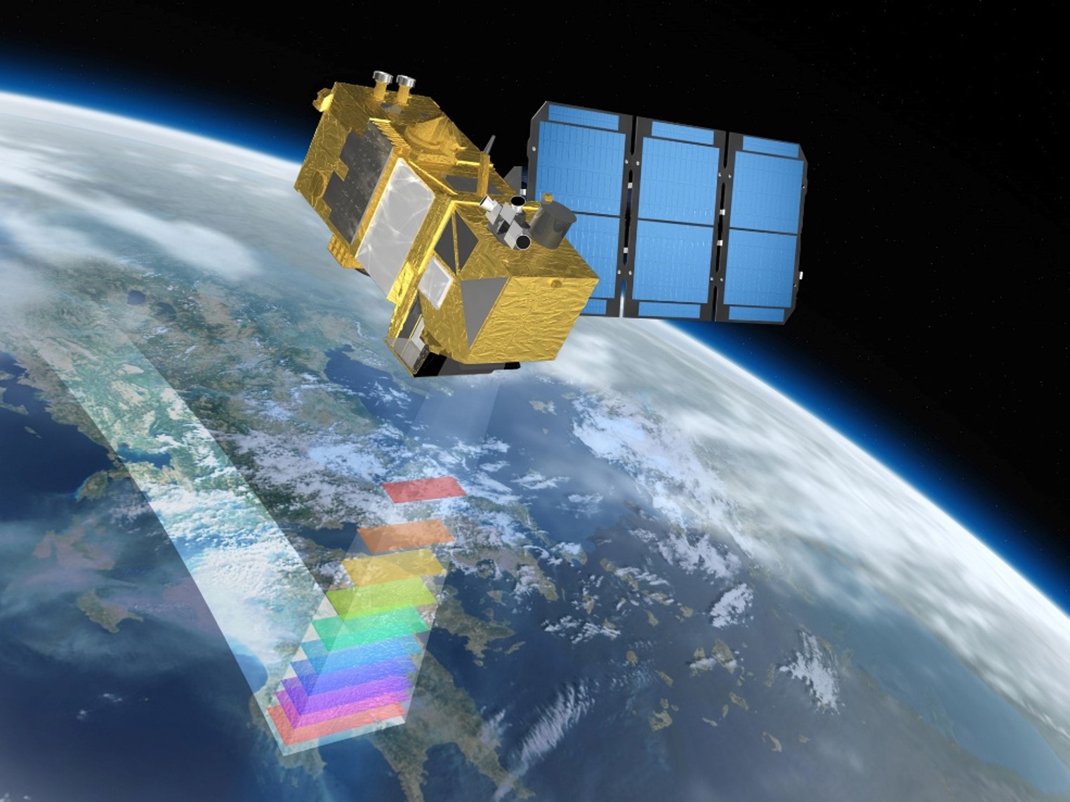
At the core of Copernicus are the Sentinel satellites, each designed for specific monitoring purposes:
These satellites provide consistent and reliable datasets, ensuring global coverage and regular updates.
Sentinel-2A and 2B capture multispectral images across 13 optical bands ranging from visible to infrared, with spatial resolutions of 10, 20, and 60 meters. With global coverage every five days, Sentinel-2 data is highly valuable for applications in agriculture, forestry, water management, and land-use monitoring.
By combining different spectral bands, users can generate various analytical products, such as:
These tools allow for detailed environmental assessments and monitoring over time.
A case study was presented using MODIS satellite data to map eco-climatic regions in Italy through spatial clustering techniques (Ippoliti et al., 2019). Seven environmental variables (e.g., temperature, rainfall, vegetation indices) were analyzed at three spatial resolutions (250 m to 2 km). Principal Component Analysis and k-medoids clustering grouped areas into ecoregions. These regions were then compared with two datasets related to Bluetongue vectors and West Nile Disease (WND) outbreaks. This satellite-based approach is an example of how satellite data and modelling can support targeted surveillance and prevention strategies for disease vectors.
The workshop introduced the Copernicus Data Space Ecosystem Browser, a free, user-friendly online platform offering access to Sentinel and other EO datasets. Participants learned how to register, search for data, apply filters, view imagery, perform basic analysis, download data, and create visual products like timelapse animations.
The hands-on session guided participants through the following steps:
The satellite data workshop marked the first training event of the PROVNA2 project. Tutors remain available to participants for any follow-up discussions or questions on the topic. Participants are encouraged to apply the knowledge gained both within the project framework and in broader contexts where relevant. Additional training sessions will be organised in line with the project’s capacity building programme, to further strengthen epidemiological, entomological and diagnostic capacities of the participating countries.
•Copernicus Data Space Ecosystem Browser – https://browser.dataspace.copernicus.eu/ (accessed 07/04/2025)
•Copernicus Programme – https://sentiwiki.copernicus.eu/web/copernicus-programme (accessed 07/04/2025)
•Ippoliti C, Candeloro L, Gilbert M, Goffredo M, Mancini G, et al. (2019) Defining ecological regions in Italy based on a multivariate clustering approach: A first step towards a targeted vector borne disease surveillance. PLOS ONE 14(7): e0219072. https://doi.org/10.1371/journal.pone.0219072
